The Saturday after the elections, to get away from all the stress, Yang and I took a four-mile hike on the Keystone Arch Bridges Trail. It  was something! The trail leads through woods in Chester to one of the oldest set of stone railroad bridges in the country. And some of these bridges are still in use! Here is the first of these arched granite bridges that we saw, one that is still used. We just missed the train going over it. was something! The trail leads through woods in Chester to one of the oldest set of stone railroad bridges in the country. And some of these bridges are still in use! Here is the first of these arched granite bridges that we saw, one that is still used. We just missed the train going over it.
To get to the other arch bridges, you have to do some hiking through the forests. The paths run along the river and then up and down some semi-tough slopes. However, the work is certainly worth it. There were some cool views of woods, streams, and rock formations. the forests. The paths run along the river and then up and down some semi-tough slopes. However, the work is certainly worth it. There were some cool views of woods, streams, and rock formations.

 Before we got to the other bridges, we came across some interesting abandoned or ruined structures. We could see this tower piercing through the denuded trees not too far off to the right of the trail as we started. I’m not sure what it is, so if anyone has an idea, let me know. We would have investigated on the way back – there was a drive off the trail – but we were really bushed. Before we got to the other bridges, we came across some interesting abandoned or ruined structures. We could see this tower piercing through the denuded trees not too far off to the right of the trail as we started. I’m not sure what it is, so if anyone has an idea, let me know. We would have investigated on the way back – there was a drive off the trail – but we were really bushed.
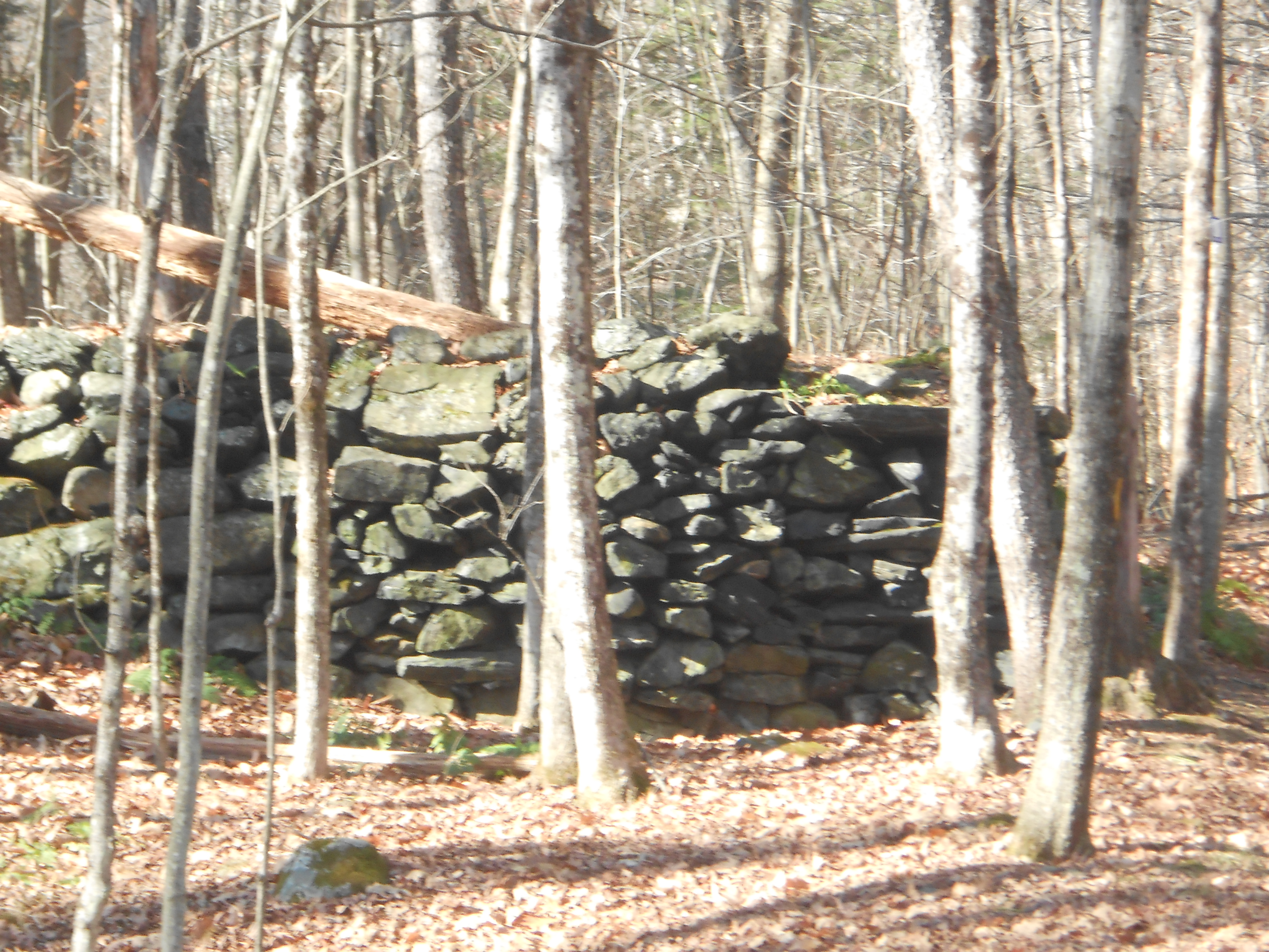
 I don’t know what this rock wall was originally. A foundation? A pen? A border demarcation? Can’t tell you. Cool, though, isn’t it? I don’t know what this rock wall was originally. A foundation? A pen? A border demarcation? Can’t tell you. Cool, though, isn’t it?
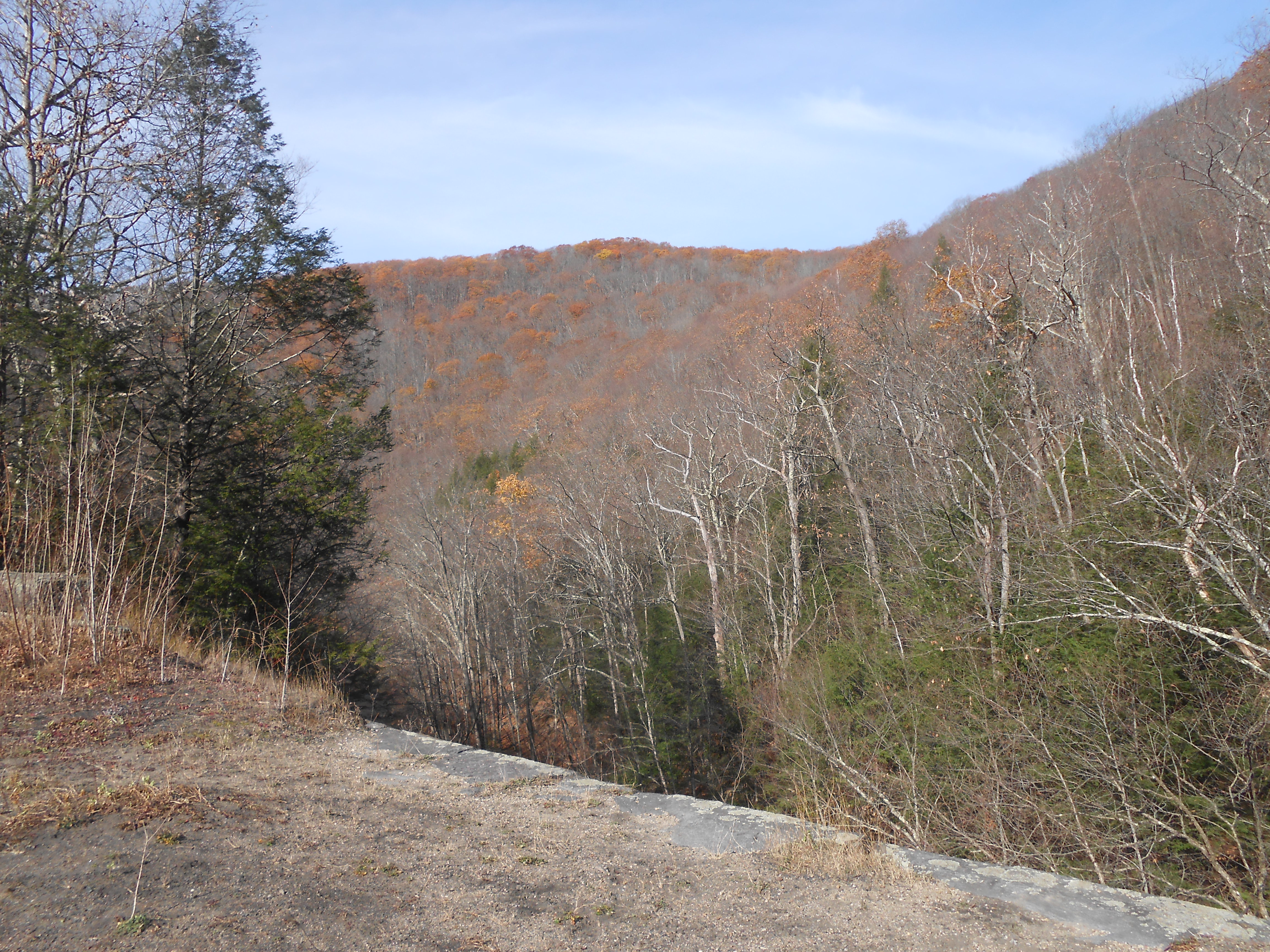
We were able to check out two of the abandoned bridges. These were built around 1840, using blue-stone granite. This part of the line was eventually abandoned along with the bridges because in following  the river, the rails had to take too sharp a curve for the speed of the trains. Disaster prevailed. To get to this bridge, we walked along where the old rail bed was, between high walls of rock that had been blasted and dug out in the early/mid-1800s. At the bridge, the tunnel of rock opened into a beautiful view of the surrounding mountains. There was still some color in the trees, so I could just imagine how gorgeous the vista would have been even a week earlier. the river, the rails had to take too sharp a curve for the speed of the trains. Disaster prevailed. To get to this bridge, we walked along where the old rail bed was, between high walls of rock that had been blasted and dug out in the early/mid-1800s. At the bridge, the tunnel of rock opened into a beautiful view of the surrounding mountains. There was still some color in the trees, so I could just imagine how gorgeous the vista would have been even a week earlier.
 In this shot, you can see the handsome Yang sitting near the edge-I made sure his insurance was paid up before the hike. Click on the picture and look below him to the right to see the river. Above that, note the rest of the mountains to get an idea of how high up we are. To the left, you can see the path that came out of the rail bed we walked up between walls of rock. In this shot, you can see the handsome Yang sitting near the edge-I made sure his insurance was paid up before the hike. Click on the picture and look below him to the right to see the river. Above that, note the rest of the mountains to get an idea of how high up we are. To the left, you can see the path that came out of the rail bed we walked up between walls of rock.
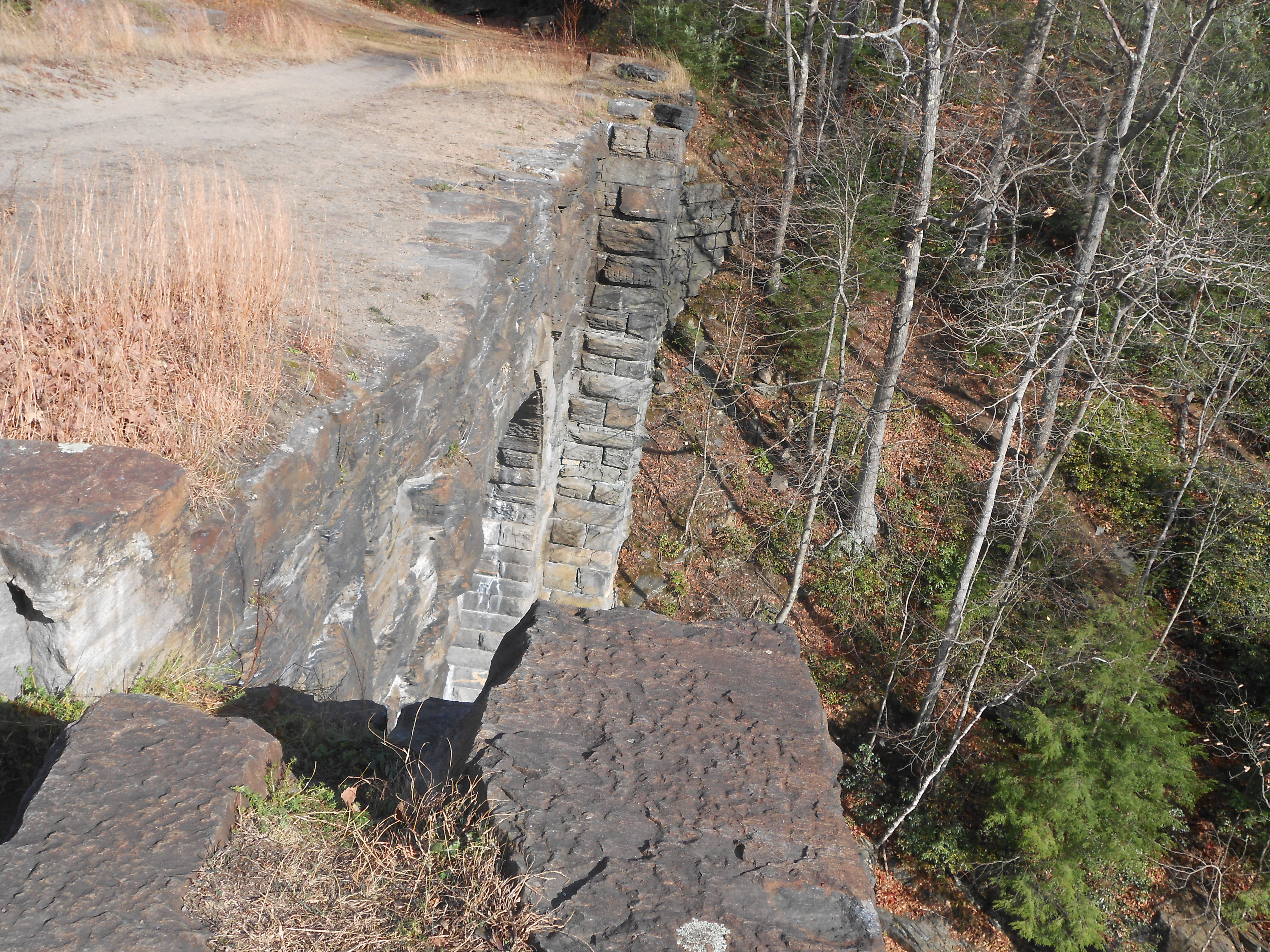
This picture can give you an even better idea of how high up the  bridge is. It’s taken on the same side of the bridge as the shot of Yang above, but from the other end of the bridge. Click on the picture and notice the tiny patches of blue at the bottom, on the river bank. Those tiny things are two people! Pretty far down, huh? The acoustics are darned good, though. We could hear those two girls laughing and joking as if they were right there on the bridge with us. bridge is. It’s taken on the same side of the bridge as the shot of Yang above, but from the other end of the bridge. Click on the picture and notice the tiny patches of blue at the bottom, on the river bank. Those tiny things are two people! Pretty far down, huh? The acoustics are darned good, though. We could hear those two girls laughing and joking as if they were right there on the bridge with us.
 Here’s a shot of the other abandoned bridge, also on the same line. Though I didn’t get a picture of the surrounding hills, the view of them from here was also impressive, even with fall’s glory of color having passed. This trail is certainly worth a return trip at almost any time of year-well, maybe not through winter snows! Here’s a shot of the other abandoned bridge, also on the same line. Though I didn’t get a picture of the surrounding hills, the view of them from here was also impressive, even with fall’s glory of color having passed. This trail is certainly worth a return trip at almost any time of year-well, maybe not through winter snows!
Click here for more information on the Keystone Arch Bridges Trail.
|